* Astronomy

Members Login
Username 
 
Password 
    Remember Me  
Post Info
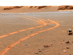
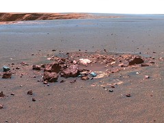
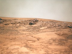
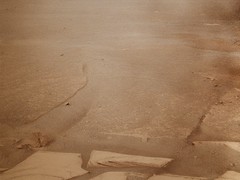
TOPIC: The Opportunity rover


L

Posts: 131433
Date:
RE: The Opportunity rover
Permalink  


OPPORTUNITY UPDATE: Opportunity Proceeds with Caution on Sandy Slopes - sol 1437-1443, Feb 14, 2008:

After recovering from a stall in Joint 1, which controls the compass orientation of the shoulder on the rover's robotic arm, Opportunity is proceeding carefully to its next target, an exposure of layered rocks known as "Gilbert."
Opportunity ran the usual diagnostic tests for this sort of fault, which occurred while the rover was studying a rock target known as "Buckland," and successfully placed the Mössbauer spectrometer on the target on Sol 1437 (Feb. 8, 2008). On Sol 1438 (Feb. 9, 2008), the rover's handlers decided to relinquish further scientific studies of the target and proceed instead with a drive toward Gilbert. As this meant the rover would wander into new terrain, the team created a series of steps to allow Opportunity to characterise the surroundings along the way.
One of these steps involved placing the front two wheels on an area of soil to leave a scuff on the surface and backing up to take images of the exposed area. On Sol 1438, however, prior to reaching the intended soil area, Opportunity aborted the drive. The rover completed the second planned "scuffing" on Sol 1441 (Feb. 12, 2008). This time the scuff was successful, though it revealed an interesting surprise -- Opportunity's right front wheel dug in much more than the rover's handlers had expected, highlighting the need to proceed cautiously toward Gilbert.
Because Opportunity was unable to relay all of the diagnostic data to Earth at one time because the volume of data was more than could be accommodated, the rover's handlers decided that the prudent course of action was to wait one planning cycle before having Opportunity proceed with the drive. On Sol 1443 (Feb. 14, 2008), Opportunity completed a diagnostic examination of the grind bit on the rock abrasion tool and collected a mosaic of microscopic images of a rock target dubbed "Lyell Exeter," commemorating the college attended by geologist Sir Charles Lyell in the early 1800s, as well as compositional data using the alpha-particle X-ray spectrometer.
Opportunity is healthy and all subsystems are performing as expected. The latest available measurements on Sol 1443 showed a power level of 469 watt-hours (100 watt-hours is the amount of energy needed to light a 100-watt bulb for 1 hour). Plans for the coming weekend called for the rover to proceed with the first of a two-step drive toward Gilbert.

Sol-by-sol summary:
In addition to receiving instructions directly from Earth via the rover's high-gain antenna, relaying data to Earth via the UHF antenna on the Mars Odyssey orbiter, and assessing atmospheric dust levels with the panoramic camera, Opportunity completed the following activities:

Sol 1437 (Feb. 8, 2008): Opportunity recovered from last week's stall of Joint 1 on the robotic arm, successfully placing the Mössbauer spectrometer on the surface of the rock target dubbed "Buckland" and spending 12 hours studying iron-bearing minerals with the instrument. The rover acquired a 2-by-1 mosaic of images of dunes with the panoramic camera.

Sol 1438: Opportunity surveyed and took spot images of the sky with the panoramic camera. The rover acquired movie frames in search of clouds with the navigation camera before rolling a short distance to get into position for a photo session, during which the rover took full-colour images of Buckland, using all 13 filters of the panoramic camera. Opportunity then drove in the direction of Gilbert and acquired a mid-drive, 3-by-1 image mosaic of Gilbert using the panoramic camera. The rover collected a 2-by-2 mosaic of post-drive images with the navigation camera, took images with the hazard avoidance cameras, and unstowed the robotic arm. Opportunity was unable to complete a planned soil scuff followed by a backward drive.

Sol 1439: After awakening, Opportunity took spot images of the sky, surveyed the horizon, and surveyed the sky at high Sun with the panoramic camera. Opportunity then completed a systematic ground survey, using all 13 filters of the panoramic camera. After relaying data to NASA's Odyssey orbiter as it passed overhead, the rover studied argon gas in the Martian atmosphere with the alpha-particle X-ray spectrometer.

Sol 1440: Upon receiving enough solar energy to wake up autonomously, Opportunity took thumbnail images of the sky with the panoramic camera. The rover searched for morning clouds in movie frames taken with the navigation camera, took spot images of the sky with the panoramic camera, and monitored dust accumulation on the mast assembly. Opportunity made additional measurements of atmospheric argon with the alpha-particle X-ray spectrometer after transmitting data to Odyssey.

Sol 1441: Upon awakening, the rover surveyed the sky with the panoramic camera. Opportunity then acquired movie frames in search of morning clouds with the navigation camera. The rover stowed the robotic arm, scuffed the soil with its wheels while driving toward Gilbert, and acquired a 3-by-1 mosaic of post-drive images of Gilbert with the panoramic camera as well as a 2-by-2 mosaic of navigation camera images and hazard avoidance camera images. Opportunity unstowed the robotic arm.

Sol 1442: Upon awakening, Opportunity took spot images of the sky and surveyed the horizon with the panoramic camera. The rover also surveyed the sky at high Sun with the panoramic camera.

Sol 1443 (Feb. 14, 2008): Upon awakening, Opportunity took thumbnail images of the sky with the panoramic camera and acquired movie frames in search of clouds with the navigation camera. The rover surveyed the grinding bit on the rock abrasion tool and acquired a 2-by-2-by-14 stack of stereo microscopic images of Lyell Exeter. Opportunity placed the alpha-particle X-ray spectrometer on Lyell Exeter, acquired a 2-by-1 mosaic of images of Gilbert with the navigation camera, and, after sending data to Odyssey, collected compositional data with the spectrometer. The following morning, Opportunity was to acquire full-colour images, using all 13 filters of the panoramic camera, of the area exposed by the rover's wheels and survey the sky at high Sun with the panoramic camera.

Odometry:
As of sol 1443 (Feb. 14, 2008), Opportunity's total odometry was 11,668.08 metres.

__________________


L

Posts: 131433
Date:
Permalink  
 

Image taken by the Opportunity rover on Sol 1444.

OPPSol 1444
Expand (394kb, 1024 x 768)
Credit NASA


__________________


L

Posts: 131433
Date:
Permalink  
 

This view from NASA's Mars Exploration Rover Opportunity shows bedrock within a stratigraphic layer informally named "Gilbert," which is the rover's next target after completing an examination of three stratigtaphic layers forming a bright band around the inside of Victoria Crater. The rover will descend deeper into the crater to reach the Gilbert layer.
Opportunity used its panoramic camera (Pancam) to capture this image with low-sun angle at a local solar time of 3:30 p.m. during the rover's 1,429th Martian day, of sol (Jan. 31, 2008).

Gilbert
Expand (339kb, 1024 x 768)
Expand (1.2mb, 1024 x 1024)
Credit NASA

Source

__________________


L

Posts: 131433
Date:
Permalink  
 

OPPORTUNITY UPDATE: Still Grinding After All These Years - sol 1389-1395, Feb 06, 2008:

With only about a month remaining before Opportunity's fourth anniversary (in Earth years) of Mars exploration, NASA's robotic geologist is still grinding into the surface of rocks to unlock the secrets of their interior chemistry. Meanwhile, fall arrived in the southern hemisphere of Mars on Dec. 9, 2007, Opportunity's 1,378th Martian day, or sol, of exploration of the Red Planet. Ten days later, Earth made its closest approach to Mars, coming within 88 million kilometres.
Opportunity used the rock abrasion tool to bore a shallow hole into a rock target known as "Lyell_1" and then spent about 70 hours integrating data about iron minerals inside the rock using the Mössbauer spectrometer.

Sol-by-sol summary:
In addition to morning uplinks directly from Earth via the rover's high-gain antenna, evening downlinks to Earth via the Odyssey orbiter at UHF frequencies, and panoramic camera measurements of atmospheric opacity caused by dust, Opportunity completed the following activities:

Sol 1389 (Dec. 20, 2007): Opportunity acquired panoramic camera images of the turret, placed the Mössbauer spectrometer on Lyell_1, and acquired approximately 12 hours worth of data with the instrument.

Sol 1390: In the morning, Opportunity surveyed the horizon with the panoramic camera. The rover restarted the Mössbauer spectrometer and spent approximately 12 hours integrating data with the instrument. Opportunity acquired a 13-by-1 mosaic of panoramic camera images of Lyell_1 and used the navigation camera to pinpoint the Sun's location in support of the upcoming Mars Science Laboratory mission. The rover went into a mini-deep sleep.

Sol 1391: Upon solar array wakeup, Opportunity monitored atmospheric dust and then monitored dust on the rover mast assembly. The rover restarted the Mössbauer spectrometer and spent about 12 hours integrating data from Lyell_1 with the instrument. Opportunity acquired a 5-by-1 tier of navigation camera images and, after communicating with Odyssey, went into a mini-deep sleep.

Sol 1392: Opportunity restarted the Mössbauer spectrometer integration of Lyell_1 and spent about 12 hours collecting data with the instrument. Opportunity acquired a 4-by-1 mosaic of images looking downslope at a target known as "Gilbert." The rover went into a mini-deep sleep.

Sol 1393: Upon solar array wakeup, Opportunity measured atmospheric dust and acquired Part 1 of a panoramic camera mosaic of foreground images. Opportunity spent another 12 hours engaged in Mössbauer spectrometer analysis of Lyell_1 and, after communicating with Odyssey, went into a mini-deep sleep.

Sol 1394: Following solar array wakeup, Opportunity monitored atmospheric dust and acquired Part 2 of the panoramic camera mosaic of foreground images. The rover conducted a survey at high Sun with the panoramic camera, restarted the Mössbauer spectrometer, and spent about 12 hours integrating data from the instrument. The rover went into a mini-deep sleep.

Sol 1395 (Dec. 27, 2007): Upon solar array wakeup, Opportunity measured atmospheric dust and scanned the sky for clouds with the navigation camera. Opportunity swung the robotic arm out of the way of the hazard avoidance camera, acquired full-colour images of Lyell_1 using all 13 filters of the panoramic camera, and swung the robotic arm back into place over Lyell_1. The rover acquired stereo microscopic images of Lyell_1 and placed the alpha-particle X-ray spectrometer on Lyell_2. After communicating with Odyssey, Opportunity spent approximately 17 hours integrating Mössbauer spectrometer data from Lyell_2. The following morning, after communicating with Odyssey, Opportunity was scheduled to measure atmospheric dust and take thumbnail images of the sky with the panoramic camera.

Odometry:
As of sol 1395 (Dec. 27, 2007), Opportunity's total odometry remained at 11,591.21 metres.

__________________


L

Posts: 131433
Date:
Permalink  
 

Image of Duck Bay taken by the Opportunity rover on January 25, 2008, (Sol 1423).

oppsol1423_4
Expand (103kb, 1024 x 274)
Credit NASA

oppsol1423_5
Expand (254kb, 1024 x 768)
oppsol1423_6
Expand (253kb, 1024 x 768)


__________________


L

Posts: 131433
Date:
Permalink  
 

Image taken by the Opportunity rover on Sol 1419

OppSol1419
Expand (199kb, 1024 x 768)


Credit NASA

__________________


L

Posts: 131433
Date:
Permalink  
 

This view from Opportunity shows the tracks left by a drive executed with more onboard autonomy than has been used on any other drive by a Mars rover.

PanCratere4
Expand (192kb, 1024 x 408)
This view combines separate images taken through the Pancam filters centred on wavelengths of 753 nanometers, 535 nanometers and 432 nanometers. It is presented in a false-colour stretch to bring out subtle colour differences in the scene.
Credit: NASA/JPL-Caltech/Cornell University

Opportunity made the curving, 15.8-metr drive during its 1,160th Martian day, or sol (April 29, 2007). It was testing a navigational capability called "Field D-star," which enables the rover to plan optimal long-range drives around any obstacles in order to travel the most direct safe route to the drive's designated destination. Opportunity and its twin, Spirit, did not have this capability until the third year after their January 2004 landings on Mars. Earlier, they could recognise hazards when they approached them closely, then back away and try another angle, but could not always find a safe route away from hazards. Field D-Star and several other upgrades were part of new onboard software uploaded from Earth in 2006. The Sol 1,160 drive by Opportunity was a Martian field test of Field D-Star and also used several other features of autonomy, including visual odometry to track the rover's actual position after each segment of the drive, avoidance of designated keep-out zones, and combining information from two sets of stereo images to consider a wide swath of terrain in analysing the route.

MarCratere4
Expand (400kb, 1024 x 768)
Cratere2
Expand (398kb, 1024 x 768)
Credit: NASA/JPL-Caltech/Cornell University

Two days later, on Sol 1,162, (May 1, 2007), Opportunity was still at the location it reached during that drive, and the rover's panoramic camera (Pancam) took the exposures combined into this image.
Victoria Crater is in the background, at the top of the image. The Sol 1,160 drive began at the place near the centre of the image where tracks overlap each other. Tracks farther away were left by earlier drives nearer to the northern rim of the crater. For scale, the distance between the parallel tracks left by the rover's wheels is about 1 meter from the middle of one track to the middle of the other. The rocks in the centre foreground are roughly 7 to 10 centimetres tall. The rover could actually drive over them easily, but for this test, Settings in the onboard hazard-detection software were adjusted to make these smaller rocks be considered dangerous to the rover. The patch of larger rocks to the right was set as a keep-out zone. The location from which this image was taken is where the rover stopped driving to communicate with Earth. A straight line from the starting point to the destination would be 11 metres. Opportunity plotted and followed a smoothly curved, efficient path around the rocks, always keeping the rover in safe areas.

__________________


L

Posts: 131433
Date:
Permalink  
 

Image of the inside of Victoria crater taken by the Opportunity rover on Sol 1390.

OppSol 1390
Expand (248kb, 1024 x 768)
Credit NASA


__________________


L

Posts: 131433
Date:
Permalink  
 

Image taken by the Opportunity rover on Sol 1392

OPP1392
Expand (245kb, 1024 x 768)


Credit NASA

__________________


L

Posts: 131433
Date:
Permalink  
 

Image taken by the Opportunity rover on Sol 1388.

OppSol 1388
Expand (114kb, 560 x 400)
Credit NASA

-- Edited by Blobrana at 23:32, 2007-12-22

__________________
«First  <  117 18 19 20 2155  >  Last»  | Page of 55  sorted by
Quick Reply

Please log in to post quick replies.


Create your own FREE Forum
Report Abuse
Powered by ActiveBoard